Accessing and Sharing Data Online
There has been a tremendous increase in the number and quality of online resources that allow access to data and data products in recent years. User-friendly platforms based on accessing and combining online datasets have recently been developed by federal, academic, and non-governmental organizations. The capabilities of these products vary but overall are substantial. Additionally, there is continuing development toward improvements and new capabilities of these systems. It is now possible to not only access data from your watershed or region, but instantly create and modify analyses and data visualizations you can use on your websites and communications.
We’ve collected information on some of these current systems and provide explanations and comparisons of their capabilities, limitations, and user-friendliness. On the first tab, you can find a table of information related to each of the online data products to help you find what you’re looking for.
Water Quality Portal
The Water Quality Portal (WQP) is a cooperative service sponsored by the United States Geological Survey (USGS), the Environmental Protection Agency (EPA) and the National Water Quality Monitoring Council (NWQMC) that integrates publicly available water quality data from the USGS National Water Information System (NWIS) the EPA STOrage and RETrieval (STORET) Data Warehouse, and the USDA ARS Sustaining The Earth’s Watersheds – Agricultural Research Database System (STEWARDS).
The Water Quality Portal contains data collected by over 400 federal, state, tribal, and local agencies. To access this data, users input their chosen location, site information, sampling parameters, and preference for file format. Refer to the portal’s user guide for explanations of search parameters and data retrievals. Organizations can also upload and store their data within the portal.
There is also a Water Quality Portal Data Discovery Tool allows users to access data within the Water Quality portal with an easy to use interface. The tool uses R, an open source statistical programming software, to visualize data and perform data analysis. R must be installed before the tool can be used.
National Water Census Data Resources Portal
The National Water Census Data Portal is a hub of information that can be used by water managers, management agencies, and local watershed organizations. The portal has four main components:
- Water Budget – View and download precipitation, evapotranspiration, stream flow, and water withdrawal data for 8 and 12 digit HUC watersheds
- Streamflow Stats – Access flow data and calculate statistics for watersheds such as flow magnitude, flow frequency, flow duration, flow timing, and rate of change
- Aquatic Biology – Access aquatic biology data and corresponding streamflow statistics
- Data Discovery – Access project, data, and publications from National Water Census focus area studies
This portal was created by the National Water Census- a USGS research program focused on water availability. The National Water Census assesses water availability at regional and national scales and develops tools, like the portal, to aide in water quantity management.
River Network’s Environmental Flows and Water Security science module includes tutorials on using the National Water Census Data Resources Portal and how to use that data to learn about environmental flows.
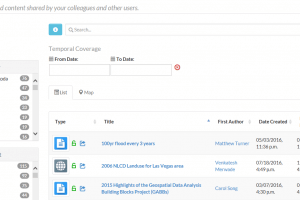
HydroSHARE
HydroSHARE is an open source program developed by CUAHSI that promotes data sharing and collaboration. Data is uploaded to HyodroSHARE through their web interface, and users fill out forms to provide essential metadata describing the data. This ensures that other users can find your data and interpret it.
-
- Search for data by author, subject, resource type, and owner
-
- Create a group to share resources
CUAHSI developed a series of webinars on HydroSHARE that will guarantee that citizen science groups, researchers, and water managers can get the most out of this program for sharing data and various models.
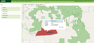
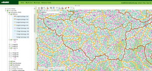
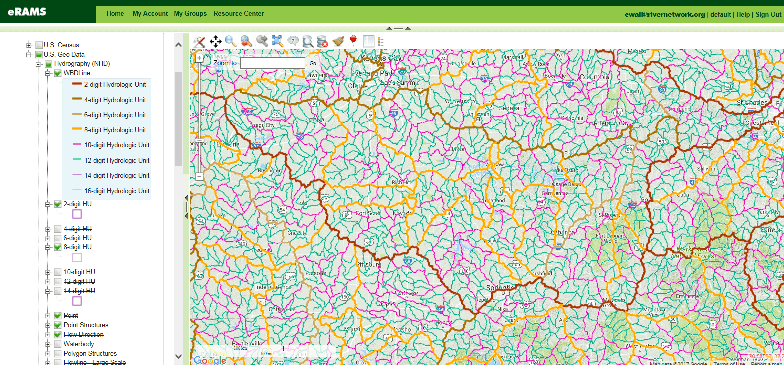
eRAMS
The environmental Resources Assessment and Management System (eRAMS) platform is a creation of Colorado State University that allows users to create a geospatial webpage. eRAMS has a variety of layers available for use that contains U.S. Census data, hydrography, roads, congressional districts, states, EPA water data, land cover, and impervious surfaces data. The One Water Solutions Institute has tutorial videos available for getting the most out of eRAMS.
There are built-in analysis tools within the eRAMS map interface to aid in analysis and modeling. These tools include:
- Measure distance and area c
- Geoprocessing
- Geostatistics
- Data extraction
- Terrain analysis
- Hydrologic analysis
-
- Want to retrieve STORET or USGS data for a specific area? Build a polygon and search that area for monitoring stations and gages

-
- Curious about land use cover in nearby watersheds? Add a hydrography and land use layer
Additional Resources
How’s My Waterway
How’s My Waterway is an app and website created by the EPA that makes water quality information easily accessible. Users can learn about the condition of streams and lakes across the United States. Information is found by either “Using My Location” or “Choose a Location”. While you cannot download data, you can access technical reports and simple descriptions regarding the waterbody’s condition, various pollutant categories, and what is being done to improve that waterway. Under the “Other Water Info” tab, information about the watershed, drinking water supplies, beaches, and fish advisories can be found.
National Groundwater Monitoring Network
National Ground-Water Monitoring Network was created by the Federal Advisory Committee on Water Information’s Subcommittee on Ground Water and contains selected wells from Federal, state, tribal, and local monitoring networks. The NGWMN’s Data Portal lets users search for current and historical data that include water levels, water quality, well construction, and lithology. Data can be filtered by specific aquifers, aquifer characteristics (type and lithology), and by monitoring categories such as trend vs surveillance and if the aquifer has anthropogenic affects.